The historicity of Lord Rama is often questioned on the grounds that there is no archaeological evidence to support that he ever lived or attacked Lanka. It is indeed true that the earliest archaeological evidence of potsherds from Sri Lanka is from around 5th century BCE from Anuradhapura.[i] The time of Lord Rama is considered to be around 2000 BCE.[ii] Therefore, there was no habitation in Sri Lanka at the time when Lord Rama lived let alone evidences of palaces and bridges that are described in the Valmiki Ramayana. Therefore, we have to relocate Lanka to a place where we get archaeological evidence; or we have to accept that Rama was not a historical figure.
What is the connection between Mandore and Ravana?
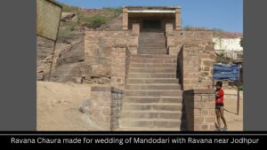
I was once visiting Mandore near Jodhpur. Ravana’s wife Mandodari is supposed to be the daughter of the king of Mandore. That is how she got her name Madodari. There is a Ravana Chaura here which is said to have been built in the honour of Ravana when he had come to wed Mandodari. Folk tellers from the area said that Ravana had come from Kutch to wed Mandodari.[i] That set me thinking about the location of Lanka somewhere in the Rann of Kutch.
In which direction did Ravana take Sita?
Rama had spent part of his exile at Panchvati near Nashik. Ravana had come to this place and kidnapped Sita and taken her to Lanka. When Rama came to know that Sita had been kidnapped, he asked to deer: in which direction Ravana took Sita? The Valmiki Ramayana says that the deer pointed to the sky and ran keeping their heads in the southern direction.[i] This gives two contradictory signals. If we take the direction of the sky to be important then the deer did not tell off any direction but if we take the keeping their head in the southern direction to be important then it means that Ravana took Sita in that direction. Both possibilities are indicated here and it cannot be said that Ravana took Sita to the south with certainty.
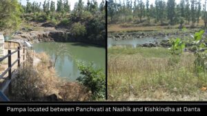
Where is the Pampa river mentioned in the Ramayana?
Next, the Valmiki Ramayana says that Rama crossed the Pampa by wading into it. Whether Pampa was a reservoir or a river is not clearly indicated because the word used for Pampa is “pushkarini” which can mean either of the two things.[i] North of Nasik there is a place called Pampa Reservoir. It is deep and it is not possible to wade into it. There is a river named Poorna that falls into this reservoir. It is possible at that time the Poorna was known as Pampa and Rama may have waded into the Poorna to cross it as told in the Valmiki Ramayana.
Was Pushpak Vimana actually a ship?
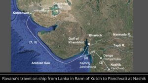
The second instance of the southern direction comes when Rama moves on searching for Sita. He went to Janasthan where he met with Jatayu who told him that Ravana had taken Sita in the southern direction. Now, it seems that Ravana was a seafarer. The description of Pushpak vehicle with large rooms and flags suggests this was a waterborne ship.[i] So, Ravana must have come to Janasthan on the ship. River Godavari that flows south of Nashik flows to the east and there is no possibility that Ravana came here on a ship on this river. The river flowing to the north of Nashik is the Tapti. There is a place named Kamrej on its banks where an ancient port has been discovered.[ii] Ravana appears to have come upstream of the Tapti to Kamrej and then may have taken the land route to Nashik to kidnap Sita.
Now, if this was the case, then Ravana would have followed the south-westward flow of the Tapti to get into the Arabian Sea from Kamrej. This south-western travel of Ravana may have been told by Jatayu to Rama as Ravana having taken Sita in the southern direction.
Where is Kishkindha of Ramayana located?
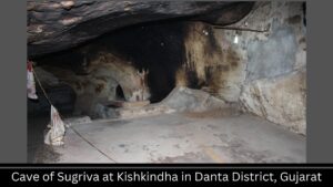
Not finding Sita at Janasthan, Rama travelled northward with Sugriva to Kishkindha. Here there is a place called Maniknath caves in District Danta. Local people say that this cave was inhabited by demons until Sage Maniknath drove them away.[i] The connection of demons with the place is thus established. These demons may have been the people of Sugriva who is also considered to have been a demon. Importantly, local people believe that Rama had come to Danta before having started the conquest of Lanka.
Hanuman’s journey: Towards south or north-west?
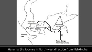
Now the second mention of the southward direction is found in the travels of Hanumana. Rama had sent Hanumana to find Sita. The Valmiki Ramayana says that Hanumana travelled in the southern direction from Kishkindha. The Maniknath cave is located on the sudden flank of a mountain. The road from Maniknath cave proceeds southward. So, Hanumana had to reach Kutch where, as we shall show shortly, Sita was taken by Ravana, from Maniknath then one has to come down from the mountain on the south and then veer around the mountain to go to Kutch. This short southward travel of Hanumana may have been mentioned in the Valmiki Ramayana.
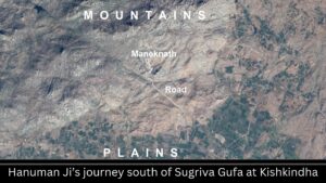
The Ramayana also says that Hanumana left in the Abhijeet Constellation. The direction associated with the Abhijeet Constellation is northwest.[i] Here, again, we have two contradictory signals from the Ramayana. On the one hand it says that Hanumana travelled in the southern direction; on the other hand, it says he travelled in the Abhijeet constellation or the northwest direction. So, can be true–Hanumana may have travelled in the southern or the northwest direction.
Sindhu of Valmiki Ramayana could be the Indus River falling into the Rann of Kutch
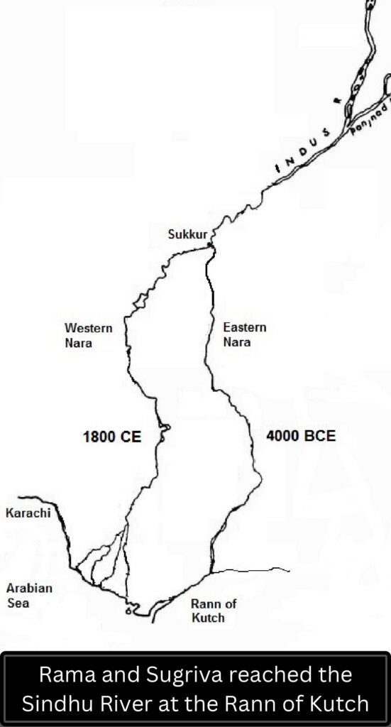
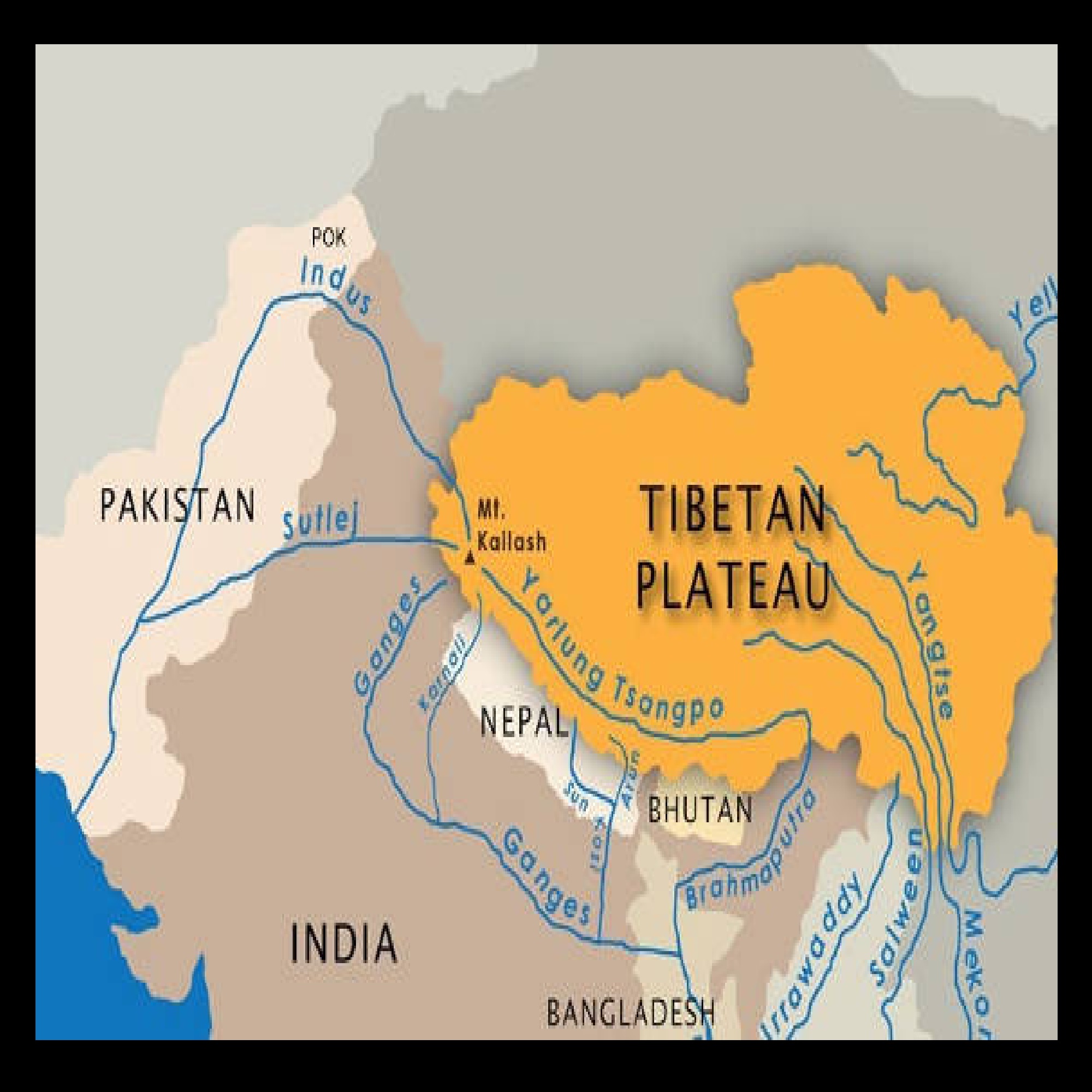
Hanumana located Sita at Lanka and came back and reported to Rama. Thren Rama and Sugriva decided to march on Lanka. The Valmiki Ramayana says that their target was to reach the banks of the Sindhu. Now normally it is understood that Sindhu is a synonym for the sea. This is the third mention of the southern direction. But the more direct association is found with the Sindhu River. At the time of Rama at 2000 BCE, the Indus or the Sindhu River was flowing to east to her present course and it was emptying into the Rann of Kutch.[i] Therefore, Rama and Sugriva going to the banks of the Sindhu could be the Rann of Kutch.
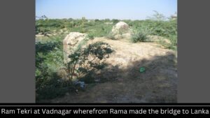
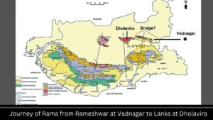
A possibility is that they camped at Vadnagar that lies about 50 km to east of the Rann of Kutch. There is a placed called Rama Tekadi. Here some ancient bricks are seen which, to my knowledge, have not been carbon dated yet.
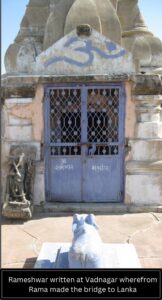
There is also a small temple by the name Rameshwar on the mound which is the place mentioned in the Ramayana as the place where they started making the bridge to Lanka.
There are two islands as one approached the Rann westward from Vadnagar. Then there is a third bigger island known as Khadir on which the ancient site of Dholavira is located. Rama had to cross the sea between these islands. The Hindu texts say that Rama’s army uprooted trees, tied stones to them and threw them in the sea. Such a strategy would be perfect for the shallow Rann of Kutch where the maximum depth is about 20 feet. The stones would sink into the seabed and hold the trees in their position. One could jump from one floating branch to another and cross the sea. This may have been the bridge made by Rama.
Interestingly, before Rama started making the bridge, he had discharged an arrow which he had placed on his bow to threaten the Sea to give him a path to Lanka. The Valmiki Ramayana says that the place where the arrow fell became a hole and it was named “Vrann.”[i] Here we have a clear association of the “Rann” of Kutch and the “Vrann” of the Ramayana. It seems that Rama made the bridge over the Rann of Kutch and reached Dholavira.
What is Dholavira famous for?
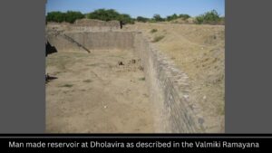
The Valmiki Ramayana says that Lanka had manmade reservoirs.[i] In Dholavira we have more than four large manmade reservoirs. There is a place named Lanki Bajar on the island of Khadir. There is a place named Lanki Dungra south of Dholavira on the other bank of the Rann. We have the name Lanka embedded in Lanki Bajar and Lanki Dungra. There are folk tales about Rama having come here.
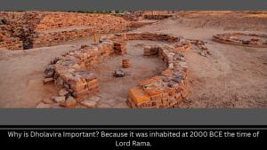
Rama crossed the Rann, went to Dholavira, fought with Ravana and liberated Sita. Dholavira was inhabited from about 3000 BCE.[i] So, if we consider Rama to have lived at around 2000 BCE, then we get archaeological evidence in support of this being the Lanka. Rama went back to Ayodhya after reclaiming Sita here.
As an aside, the narrative of Rama in the Hindu texts and that of Abraham in the Bible are substantially similar. Rama left southward with his wife and his brother. Abraham left South ward with his wife and his nephew. After reaching south, Rama’s wife Sita was kidnapped by Ravana. After reaching south, Abraham’s wife Sara was taken by the people to the palace of the Pharaoh. Rama retrieved Sita from Ravana after killing him. Abraham was given Sarah back by the Pharaoh. Rama went back to Ayodhya after reclaiming Sita. Abraham went back after getting back Sarah.
In conclusion, the archaeological, geographical, etymological and ethnographic evidences suggest that Lanka could be located at Dholavira. This establishes the historicity of Lord Rama.
Note: To watch the video on YouTube, Click Here
Also Read
- Could Lanka be Located at Dholavira?
- Are Noah and Manu the same person?
- Where was the Garden of Eden located: Turkey, Iraq or India?
- Allah could be Within Us
- Abraham and Moses lived in the Indus Valley?
- Are the Jews of Israel really the Yadavas of India?
References
[i] Archaeological Survey of India (2013), Excavations – Dholavira, http://asi.nic.in/asi_exca_2007_dholavira.asp, Retrieved July 24, 2013.
[i] Ramayana, Sundar Kanda 2:12.
[i] Ramayana, Yuddha Kanda 22:37-40. I am thankful to Shri R S Bisht for drawing my attention to this verse.
[i] Snelgrove, Alfred K, Migrations of the Indus River, Pakistan, in Response to Plate Tectonic Motions, Journal of Geological Society of India, Vol 30, August 1979, Page 394.
[i] Bangalore Venkat Raman, Prasna Marga, Motilal Banarsidass Publ., 1999, Page 642.
[i] Prabhu Bhai Desai, former Village Headperson of Kunwarsi Village.
[i] The Pushpaka Vimana “is thought to resemble a ship” (Monier-Williams, Monier, Sanskrit-English Dictionary, Southern Publications, Madras, 1987, Page 980).
[ii] Gupta, Sunil, Port structures at early historic Kamrej, 7th National Conference on Marine Archaeology of Indian Ocean Countries : Session 1, CSIR National Institute of Oceanography, Dona Paula, Goa, http://www.nio.org/index/option/com_eventdisplay/task/view/tid/4/sid/114/eid/28, Retrieved March 24, 2016).
[i] The Ramayana uses “Pampa” 3 times with the adjective “Pushkarini” (Ramayana, Aranya Kanda 73:10, 74:1, Kishkindha Kanda 1:1). “Pushkarini” means blue-lotus (Monier-Williams, Sanskrit-English…, Page 638). Thus, “pushkarini” could refer to a pond or a river.
[i] Ramayana, Aranya Kanda 64:16-17.
[i] Tulsi Singh Rathod at Pabuji Temple located between Jodhpur and Phalodi.
[i] Excavation Division, Prehistoric Research Excavations, Department of Archaeology, Sri Lanka, www.archaeology.gov.lk/web/index.php?option=com…id…, 2013, Retrieved July 24, 2013.
[ii] Roy, S B, “Scientific (Astro-Dynastic) Chronology of Ancient India,” in C Margabandhu et. al., Editors, Indian Archaeological Heritage, Agamkala Prakashan, Delhi, 1991, Page 702-703.


